For Project Managers

One platform across every project. 


Complete visibility.

Steel Shire gives project managers a single, live system across ROW acquisition, GIS mapping, construction tracking, and reporting - so you spend your time running the project, not chasing it.

15,000+
Miles of linear infrastructure managed on platform

Purpose-Built for How
Projects Actually Run.

Steel Shire wasn't adapted from a generic tool. Every product was built around the real complexity of linear infrastructure and the people managing it.
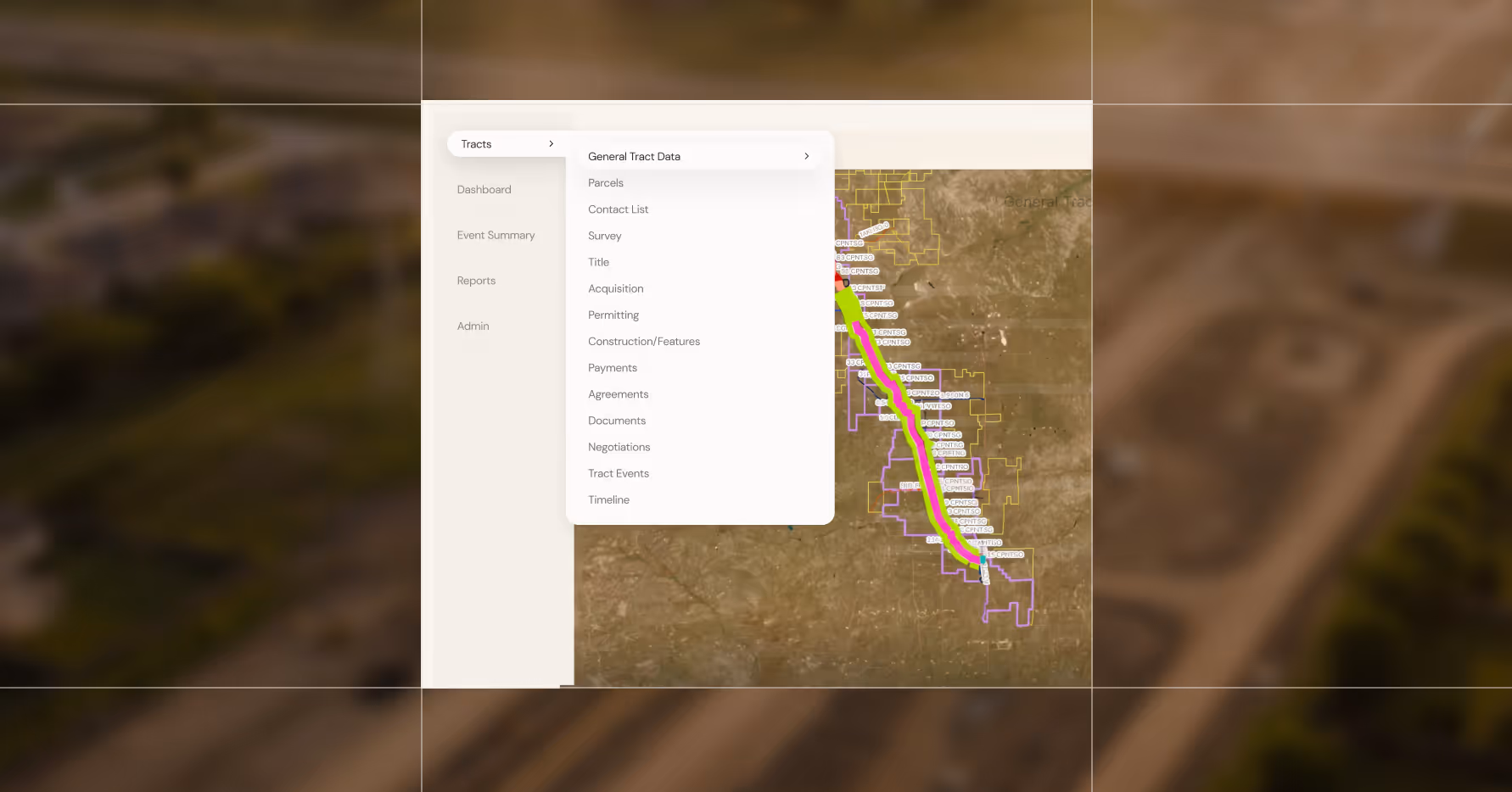
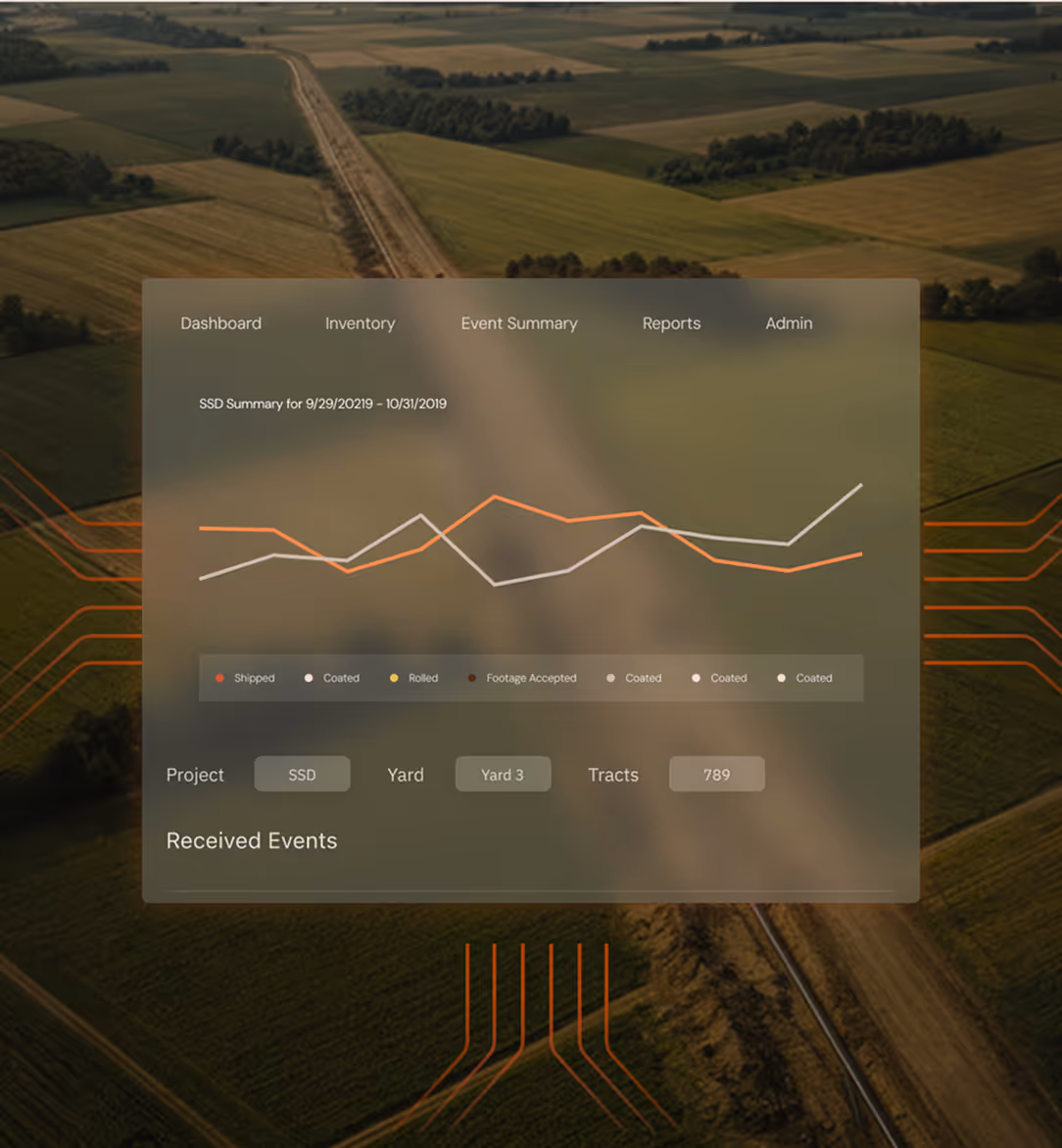
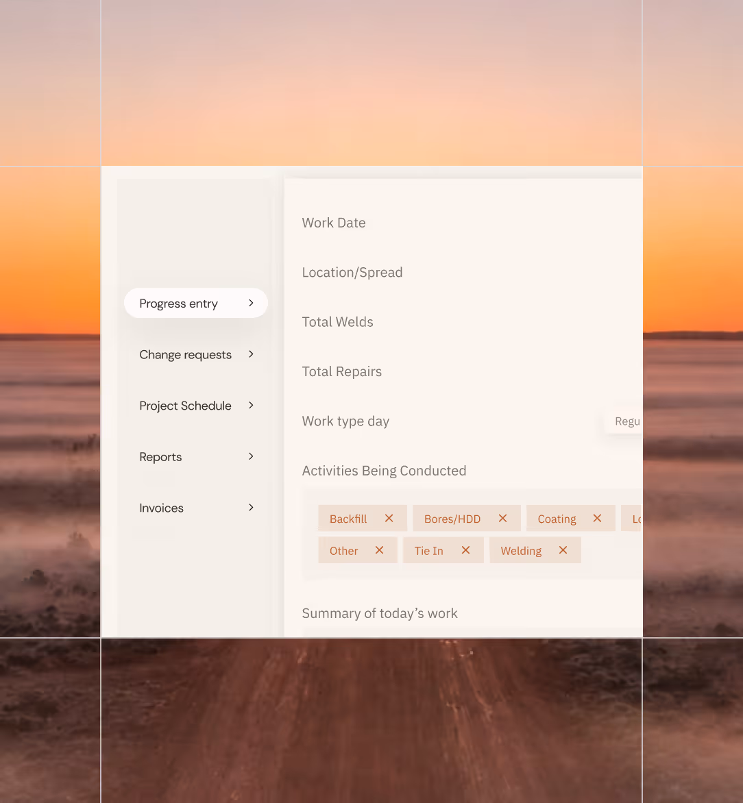
One System, Every Phase

From first tract contact to final inspection, every team works from the same live data. No spreadsheets, no conflicting reports, no chasing updates.

We Don't Just Configure. We Counsel.

With 15 years of linear infrastructure projects behind us, we bring proven best practices to every implementation, helping your team work smarter from day one, not just work differently.

Three brown rectangular boxes with arrows on top, aligned side by side.

Real-Time Visibility Across Every Team

ROW agents, GIS analysts, construction crews, and executives all work from the same live picture. Everyone aligned, all the time.

Three connected gears in a simple mechanical arrangement in gray lines.

Built for the Complexity of Linear Projects

Multi-corridor, multi-contractor, multi-jurisdiction. Steel Shire is built to handle the scale and operational demands of large linear infrastructure programs.

One Ecosystem.

Every Phase of Your Project.

Every tool in the Steel Shire platform works together, so your ROW data, GIS maps, field updates, and reports all speak the same language, all the time.

Screen showing project tracts interface with columns for tract number and ROW agent over aerial land view.
Skyray

Right-of-Way
Acquisition & Management

Skyray gives you and your ROW teams one structured system to manage every tract, document, and landowner interaction from survey permission through final handoff. No more chasing agents for updates - you see everything, live.

MOC dashboard with discussion tab showing status replies, sign-off dates, and options to add cost or upload documents.
Arpium

Your Common 
Operating Picture

Arpium puts your entire project on a live, interactive GIS map - construction progress, ROW status, MOCs, pipe location - updated the moment anything changes in the field. One map. Every team. No conflicting data.

Dashboard user interface over aerial farmland showing SSD summary chart from 9/29 to 10/31/2019.
Cobra

Pipe Tracking & 
Quality Control

Cobra tracks every joint of pipe from the yard to the ground - heat numbers, coatings, weld records, and inspection results all tied to a precise location. When something needs to be verified, you find it in seconds.

Work progress entry interface showing fields for date, location, welds, repairs, and work activities.
Havoc

Construction Management

Havoc keeps your construction schedule honest. Milestone tracking, daily reporting, and crew progress are captured in real time - so you know what's on track, what's behind, and what needs your attention before it becomes a problem.

Mountain forest landscape with a data overlay titled Atmospheric Coating Evaluation showing dates and truck info.
Blackbird

Safety & Compliance

Blackbird keeps your project on the right side of every safety requirement and regulatory obligation. Incidents, inspections, and compliance documentation are tracked and accessible - so you're always audit-ready.

Chart showing negotiation status by agent with values for Likely, Not Signing, Opposed, and Signed Pending.
Arsenal

Reporting & Dashboards

Arsenal pulls live data from every tool in the ecosystem and surfaces it in clean, structured reports. Stop spending evenings building status decks - Arsenal builds them for you, from real data, in real time.

User interface with input box asking for help on project, showing query about problematic landowners in Nelson County.
SteelNexus

AI Intelligence Across Your Entire Project

Steel Nexus is the AI layer that runs across the entire platform - surfacing patterns, flagging risk, and answering questions about your project data before you even know to ask them. The future of how project managers make decisions.

Integrations

We Integrate With the Tools Your Teams Already Use.

Steel Shire isn't built to replace your entire technology stack, it's built to work within it. We connect directly with your existing GIS, document management, and contractor systems so your team hits the ground running without a painful migration.

FAQs

Frequently Asked Questions

Have more questions?

Our team is happy to walk you through how Steel Shire works for your specific project type and scale.